When it comes to civil engineering design and planning for large scale construction projects, modelling has always been an integral part of the process - and for a good reason too. The initial designs and plans are the blueprints for all people involved in executing the design to work off, and an opportunity to visualise the build, spot problems ahead of time, analyse the full scale of the design and iron out any complications.
In the past, architects and engineers alike have worked off two dimensional drawings which can be limiting in their ability to concisely communicate the intricacies of extensive plans to all stakeholders involved. Fortunately, modern surveying and digital modelling tools have transformed the planning process into automated, three dimensional and incredibly visual designs.
The outcome? Construction companies save hours worth of manual labour, iron out communication issues on site, get a true understanding of what the finished product might look like and help to improve cost management and projections, at all stages of the construction process.
In this blog, we explore some of the most useful pieces of technology available in the realm of 3D modelling today, as well as how the NZTA utilised this technology on one of their key projects before, during and after; the Transmission Gully Project.
Top of the Line Technology: Topcon MAGNET
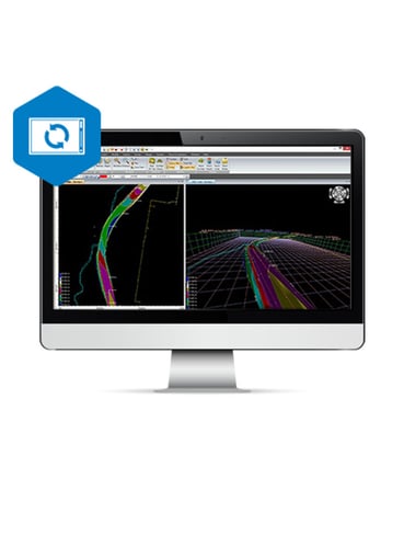
We'll start by introducing one of the most state of the art software systems on offer that allows for such detailed and highly visual projects to be designed and manager thereafter; Topcon Magnet.
Topcon Magnet is a complete package design software that allows construction companies to optimise workflow, stay profitable with earthwork estimations, integrate with machine control, and to forge a connection between head office and teams on site.
What does that mean, practically?
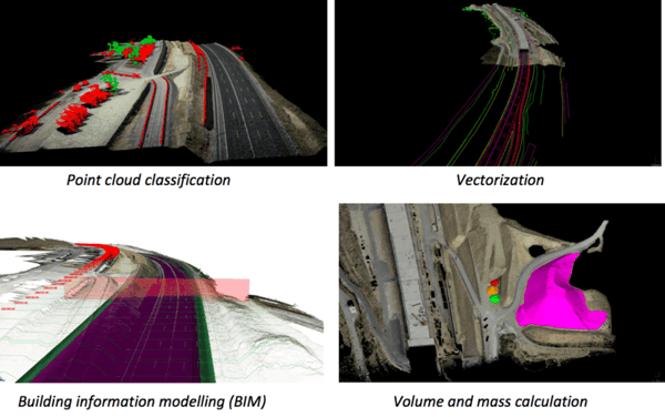
Essentially, your team will be able to upload industry standard job formats (think AutoDesk dwg/dxf and Bentley Microstation dgn files, and then use Magnet MAGNET 3D Exchange to create, edit, import/export, design, and prepare 3D job files for any job site.
Your entire team will then be able to view and use these 3D files to take to the tools and execute the job in an optimised and efficient way, without any confusion or lack of understanding due to 2D modelling. The best part is, using this software, any member of the team can instantly communicate relevant information with one another, see real-time field work being collected live on Google maps, and share or access data at anytime, anywhere in the world.
This software is genuinely revolutionary to the construction and civil engineering industry, allowing companies to complete jobs at scale, faster and for less, keeping stakeholders involved at every stage of the process through 3D and tangible visualisations.
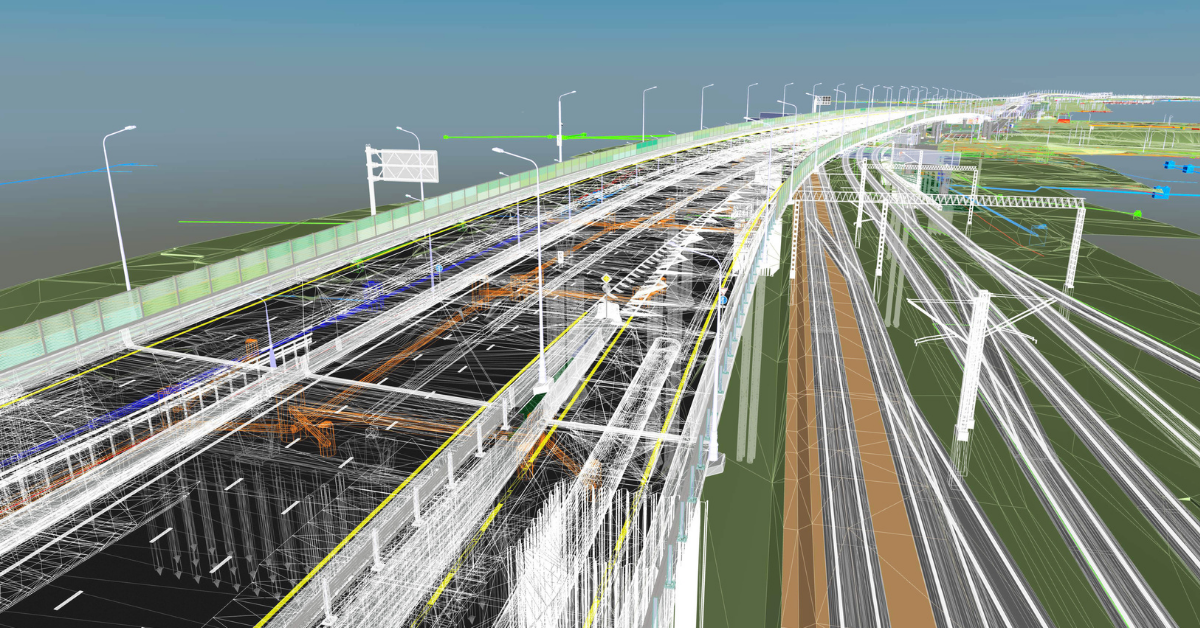
The NZTA Transmission Gully Motorway Project & 3D Modelling
The 1.25 billion dollar Transmission Gully project was planned to cover a 27 kilometre, four-lane motorway will run from Mackays Crossing to Linden, through Transmission Gully. The design and construction of the Transmission Gully motorway reflects the need for another route between Wellington and the lower and central North Island that will be safer and more reliable for motorists and better able to resist and recover from earthquakes and storms.
Of course, with a project of this size in every sense, from budget to stakeholders, physical breadth, construction resources and human resources, the most efficient, accurate and easily accessible technology was required to plan the project and iron out any potential errors ahead of time. As with anything done at scale, any minor error could have a huge impact on the job and a big cost attached.
3D modelling was utilised on this project to achieve this. Here's how.
1. Creating a near-perfect representation of the finished product
During the planning stages and before construction began on building this extensive piece of infrastructure, it was important to architects and engineers to create an accurate representation of the design and the surrounding area.
By using 3D modelling, you're able to adequately calculate costs related to ground levelling, foundation pouring, and other preparation work. It’s easier to get very accurate measurements of the materials and labour that will be needed. 3D models can have materials and engineering solutions swapped out during planning, to improve upon costs without reducing safety or stability.
All team members are then able to review it, point out any flaws, discuss potential changes, meaning everyone can be on the same page, even before any excavation has begun.
In the instance of the NZTA Transmission Gully Project, aerial mapping systems were used in conjunction with 3D software like Topcon MAGNET to quickly and easily map land that was less easily accessible.
2. Coordinate Changes Once Onsite
Once the 3D designs were created and approved, the models were then brought to life onsite. Along the way, if issues were to arise or changes needed to be made, because of the collaboration element of Topcon Magnet, team members (whether onsite or in the office) were able to review designs, resolve conflicts and coordinate changes without any miscommunications.
Even while a project is underway, you can continue to map the surrounding areas or upcoming highways to make sure your 3D models are true and accurate - something that older technology and 2D plans wouldn't easily afford.
3. Keeping your Information Accessible After the Fact
Looking forward to post completion of the Transmission Gully project, it's always important (especially on a Government sanctioned project) to have all modelling and files backed up and stored for review.
If a stretch of road or motorway needed to be upgraded and data was to be collected, modified, or extended, any addition can simply be added to the existing 3D model to simulate how they would impact the project overall.
All stakeholders would have access to the 3D model in the Topcon Cloud solution, and a solution would be able to be quickly created ad-hoc, and deliver above and beyond results.
Want to learn more?
Innovative technology and automated processes are shaping the future of construction, and if you don't have the right tools in place, you risk being left behind. Want to know? Download the FREE Guide to Connected Construction below.