

Equipping your job site with the latest next-gen Topcon products is going to improve the accuracy, productivity, and ultimately the profitability of your projects. We'll be showcasing many of these technologies at Fieldays 2021, so make sure you come and visit our stand to talk to us about which systems and equipment will help you future-proof your business.
In this blog we highlight the benefits of some next-generation equipment that will bring fast, smart and easy connectivity to your jobs – so you can operate and measure quickly and accurately with the latest technology, saving you time and money.
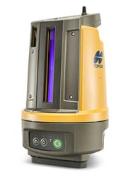
Super-Fast Connectivity with Topcon HiPer VR/HR Solutions
What problem does it solve?
The more time you spend conducting surveys, the further you delay the process of actually completing your development project which escalates costs. As a result, generating surveys as quickly as possible is a worthy goal, one that new land surveying technologies can help construction companies achieve.
How does the HiPer VR solve this problem?
The HiPer VR is packed with the most advanced GNSS technology, packaged in a compact, rugged design. The HiPer VR brings the highest speed to your machine connectivity with these features:
Multi-constellation GNSS
- Achieves high position accuracy with an increased number of satellites compared to GPS only positioning (including GPS, GLONASS, Galileo, BeiDou, QZSS, SBAS, L-Band) - less room for error with more points of contact.
- Improves success rate of positioning by receiving many more satellite signals even in harsh environments or tough terrain where GPS can be difficult.
- Future-proofed by design to continue tracking any additional GNSS signals that become available.
TILT - Topcon Inertial Leveling Technology
- Combines 9-axis IMU with ultra-compact 3-axis e-compass to accurately compensate for 15-degree tilt on the rod.
- In situations where the rod can’t be held plumb to determine the vertical (steep slopes, etc.), TILT will compensate and enable automatic accurate positioning regardless.
Super speed withLongLink™ Technology
- Longlink wireless data link provides fast, reliable, interference-free RTK base-to-rover communication.
- Also serves to automatically connect multiple rovers to the base.
What does this mean for your business?
Features like TILT are designed specifically to solve real-world challenges, such as awkward shots on steep slopes or hard to reach spots – meaning that no terrain is too difficult for the HiPer VR. LongLink™ interference-free communication will help complete your work with precision and speed, and when every minute is costing you money, speed of work is critical to your job profitability.
Click here for more information on HiPer VR, and watch the Topcon HiPer in Action with Ridgeline Engineering:
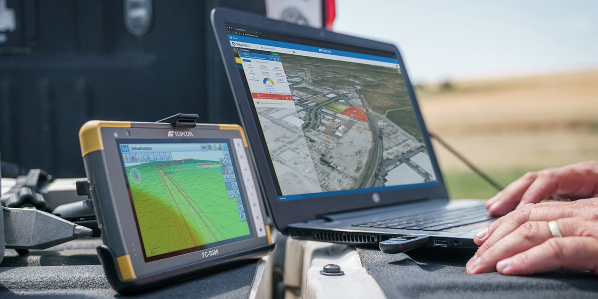
Digitise Your Layouts with the Topcon LN-150
Topcon's LN-150 layout navigator improves not only the efficiency of stake-out, but also the progress of the entire project. A layout can be completed in half the time with half the man-hours – reducing costs and margin for error. Do it once, do it right.
How does the LN-150 solve this problem?
The LN-150 is designed to be totally user-friendly and engineered specifically for contractors’ positioning needs. The layout navigator automatically locks onto the prism for real-time positioning on the go, and it features:
- Single-operator solution for precise 3D layout
- Easy one-button, self-levelling setup
- Wi-Fi and long-range Bluetooth® instrument communication options
- Seamless cloud-connected workflows with Autodesk, Bentley, and MAGNET
- MAGNET Construct mobile app for phone or tablet
What does this mean for your business?
The LN-150 can be applied to a range of activities: geo-positioning, land surveying, topography, mapping, and vertical construction.
An inexperienced surveyor can take 15 minutes in some cases to set up with an ordinary Total Station. Such a person can start measuring immediately after putting the LN-150 on the Tripod. With such easy operation, companies can even assign a non-surveying specialist to perform the layout measuring work.
Click here for more information on the LN-150
Accurate Connectivity with Skynet RTK
What problem does it solve?
RTK is immensely beneficial for improving vertical accuracy while surveying or cutting a batter in your excavator. Using a combination of RTK and waypoints, accuracy in surveying and machine control can be improved dramatically. Waypoints also create autonomous flight on pre-selected courses for aerial mapping.
How does Skynet solve this problem?
The system dynamically assigns the best high precision RTK (Real-Time Kinematic) solution for any GPS network survey task and is broadcast in the open standard of RTCM3.x, so all devices are welcome.
The RTK network provides higher levels of accuracy by removing atmospheric interference, and may eventually come to be regarded as critical infrastructure as it becomes increasingly important across a range of sectors – not just surveying. Our Skynet network consists of approximately 50 stations across the country, currently covering over 80% of the New Zealand population and providing centimetre-accurate GPS positioning for civil engineering machine automation, land survey and autonomous vehicle applications.
Skynet RTK is perfect for these sectors:
- Construction
- Surveying
- Marine
- Agriculture
- Robotics
- Automation
What does this mean for your business?
SkyNet RTK can be termed as the future of mapping and surveying. It ensures improved safety, reduced cost, and higher accuracy that makes connected plant equipment and aerial mapping solutions more precise than ever.
Click here for more information on Skynet
Automated Excavating with the Topcon X-53x
What problem does it solve?
With the Topcon's X-53x automated excavator system, the operator can bring the bucket to grade, pull one lever and it automatically traces the ground. The operator doesn’t have to think or do as much, averting overcutting and avoiding having to back-fill with more material than is necessary, which is extremely important when trying to maximise efficiencies and reduce costs. - "If you touch it twice, you may as well give them their money back."
How does the X-53x solve this problem?
Topcon’s X-53x system for excavators adds hydraulic control for fully automated digging, so you can dig to design every time, saving you time and money by eliminating over digging and costly rework. The X-53x is intuitively designed to feel like a natural extension of the operator – unlocking more productivity from seasoned operators and getting newer operators up to speed faster.
What does this mean for your business?
Perfect for mass excavation, site work, landfill, utilities and mining, the X-53x boosts excavation workflows and productivity by enabling operators of all experience levels to do more accurate work at faster speeds, meaning you have less re-work to do, saving you plenty of time across your projects.
Topcon's X-53x automated excavator technology can result in more than a 60% improvement in work efficiency when compared with conventional construction processes, achieving real savings in time, cost, materials and job accuracy.
Click here for more information on the X-53x
Come and visit us at Fieldays to take advantage of our epic deals on next-gen equipment that will be an absolute game-changer for your projects. Contact us now to beat the rush and install today.