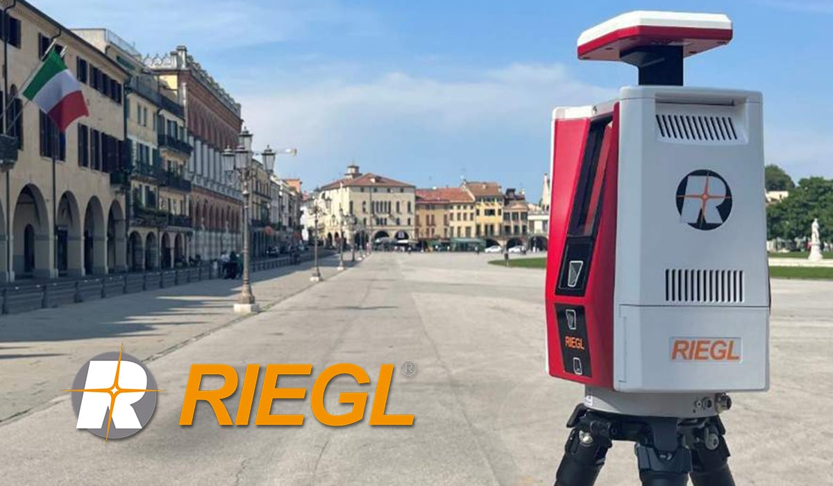
Unveiling the RIEGL VZ-600i: A Game-Changer in 3D Mapping
The world of 3D mapping just got a major upgrade with the arrival of the RIEGL VZ-600i. This next-generation laser scanner from RIEGL promises versatility, productivity, performance, and mobility, all wrapped up in a sleek, compact package. Whether you're an architect, engineer, surveyor, or simply someone who loves capturing the world in intricate detail, the VZ-600i is worth taking a closer look at.
Unmatched Versatility and Speed:
One of the VZ-600i's defining features is its broad range capability. It can effortlessly handle distances from 0.5 meters to 1 kilometre, making it equally adept at scanning grand cathedrals and intricate machinery components. And forget about long wait times. This powerhouse captures high-resolution scans with a 6mm point spacing at 10 meters in under 30 seconds. That translates to over 60 scan positions per hour with real-time registration, significantly boosting your workflow.
Lightweight Powerhouse:
Despite its formidable capabilities, the VZ-600i is surprisingly lightweight, tipping the scales at just 6kg (13 lbs). This makes it highly portable and manoeuvrable, allowing you to access even the tightest and most challenging environments with ease.
Precision that Impresses:
RIEGL hasn't compromised on accuracy either. The VZ-600i boasts an impressive 3mm 3D position accuracy, ensuring your captured data is as precise as it is detailed. This level of accuracy is crucial for applications like AEC (Architecture, Engineering, Construction), BIM (Building Information Modeling), and as-built surveying, where even the slightest deviation can have significant consequences.
Beyond the Scanner: A Robust Ecosystem:
The VZ-600i isn't just a standalone device. It's part of a comprehensive ecosystem that empowers you to get the most out of your data. RIEGL's RiSCAN PRO software provides a user-friendly platform for operating the scanner and processing the captured data. With different license levels and plugin modules, you can tailor the software to your specific needs and applications.
Specialised Plugins for Targeted Workflows:
For those delving into specific fields, RIEGL offers dedicated plugins that add an extra layer of functionality. The LIS GeoTec Plugin caters to geotechnical analysis, helping you extract crucial information from rock surfaces. For forestry professionals, the LIS TreeAnalyzer Plugin automates tree parameter extraction, saving you valuable time and effort.
Real-Time Monitoring for Critical Situations:
RIEGL takes things a step further with its four 3D terrestrial laser scanner apps for the VZ-i series. These apps enable real-time analysis and data processing, ideal for monitoring applications like landslides and open-pit mining operations. With instant access to reliable data, you can make informed decisions quickly and effectively in critical situations.
The Future of 3D Mapping is Here:
The RIEGL VZ-600i isn't just a laser scanner; it's a statement of intent. It represents the cutting edge of 3D mapping technology, pushing the boundaries of what's possible in terms of versatility, speed, accuracy, and ease of use. Whether you're a seasoned professional or just starting out, the VZ-600i has the potential to revolutionise your workflow and open up a world of possibilities.
So, are you ready to experience the future of 3D mapping?